Day 6 involved driving up the road to Paralana Hot Springs, a walk along Kingsmill Creek, Arkaroola Creek and Tillite Gorge. It was a long day as left the shearer’s quarters at 8.30 am and returned late in the afternoon. We arrived back too late for the planned 5×4 session — moreover it was too dark and windy and I was tired from the days walk.
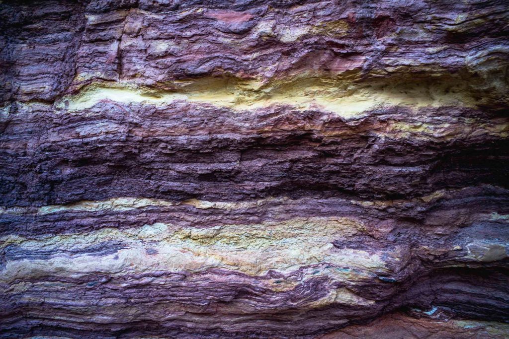
There was no water in Kingsmill Creek as we walked downstream past the the Sturt Desert Pea on the side of the boulder-strewn creek, the red river gums and over a mix of colourful and heavily marked stones and rocks. The bright yellow-brown and iron rich boulders stood out. They looked old and seemed to indicate the presence of the Paralana fault.
I was starting to think in terms of the geological history of the Vulkathunha-Gammon Ranges. No doubt a geologist would be able to read the various rock strata that I was seeing as if it were pages in an ancient archival book.
I had a sense that we were walking over glacial deposits that reached back to the Sturt glaciation, an intensely cold period of immense glaciation, which extended from the north pole to the south pole that has been described by some as ‘Snowball Earth’.
Prior to this was a significant event in South Australia, namely the formation of a giant rift valley to the east of Arkaroola some 850 million years ago. At this time, this was the east coast of Australia – there were no “eastern states” – and the Australian continent was found very close to the equator within a super-continent known to geologists as “Rodinia”. The rift valley, known as the Adelaide Geosyncline, occurred when the valley sides slowly “pulled-apart” along fault lines and the valley floor descended. This created, in a marine environment, a “geosyncline” into which eroding streams from adjacent mountains deposited their sediments.

Leave a comment