We walked across the floodplain of the Chambers Creek under overcast skies with with the Flinders Ranges behind us. We picked up and carried our own firewood and passed through the ruins of the old dog fence that ran around the southern part of Lake Frome, then around the eastern side of the lake through NSW on up to Queensland.
The skeletons and bones of wallabies and cattle lay scattered on the ground reminded us of the long drought conditions that had existed prior to the monsoonal downpour in January.

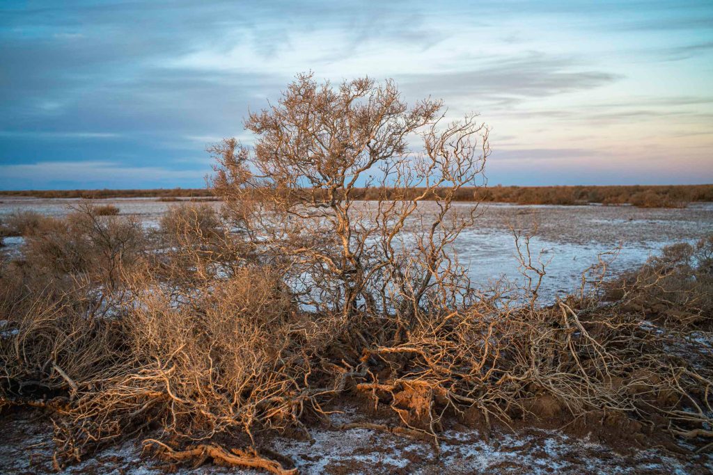
There had been water flowing across the floodplain to the lake as the ground was soft. As we made our way to the lake patches of salt started to appear on the floodplain.

We arrived at our destination at lunch time — a sand dune outcrop with scraggly, waist high acacia victoriae (food for the camels) on the edge of, and over looking the floodplain. This spot would be our camp for the night. We would leave the following morning — Day 12 was our final day of walking with the camels.
My expectations were dashed. Was this it? We had walked for 11 days with camels for this? It was desolate. What forms of life existed out here? Rabbits? Emus? E. C. Frome never actually visited Lake Frome on his 1843 expedition — he went along the east side of the range from Orrorro and turned into the ranges at Prism Hill near , Mt Serle which he thought was Mt McKinley due to Eyre’s botched longitude readings. Frome’s expedition went no further north than the present Italowie Gap.
Lake Frome was in the near distance surrounded by mud. It was more of a salt pan than a lake. The islands (or large dunes ) in the southern part of the lake, which I had hoped to walk to, were inaccessible. Ryan and Kym warned me that with the recent rain the surface of the salt lake would be treacherous, since underneath the surface is thick, deep black mud. Throughout much of Lake Frome, water makes its presence known not through standing water but through mud.

This salt lake was nothing like Lake Hart — which is what I had imagined Lake Frome would be. Then I remembered that we were on the southeastern margin of the desert and that the lake had became increasingly saline and ephemeral about 30,000 years ago with occasional flushes of freshwater. After about 15,000 years ago it was mostly a saline, groundwater-controlled playa, which is an area of flat, dried-up land, especially a desert basin or depression from which water evaporates quickly.

Leave a comment