Category: colonial
-
Sturt + the inland sea
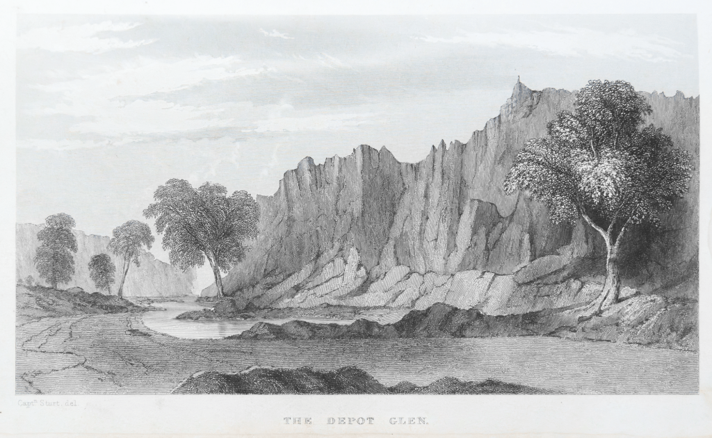
In 1844 Charles Sturt spent a couple of years looking for the inland sea. In 1827, a former East India Company officer Thomas J. Maslen, published this map of the inland sea in his book The Friend of Australia, which provided instructions for surveying and exploring the island-continent’s interior. It was a popular colonial belief that…
-
The Mawson-Spriggina walk

The second walk was an easy one. It started from the Arkaroola Village complex. It follows the Mawson Valley and returns along the Spriggina ridge. The walk is named after two geologists who had a long association with the northern Flinders Ranges — Douglas Mawson and Reg Sprig. Or more accurately, Spriggina refers to a…
-
reading Henry Reynolds

I was reading Henry Reynold’s Frontier: Aborigines, Settlers and Land whilst walking on the camel trek in a north-easterly direction towards the barren salt-encrusted land in South Australia’s arid north east of Chambers Gorge that winds its way through the Wearing Hills. Whilst walking through the dry creek beds I found it difficult to grasp…
-
Reflections on 2018 camel trek

The photographs on the 2018 camel trek to Mt Hopeless were made naively, with little awareness of the geological history of the Flinders Rangers. I had a vague awareness that the southern Flinders Rangers were conventionally seen as barren, desolate, empty and hostile — a wasteland, desert or timeless land. This is in contrast to…
-
Captain Sweet, the Flinders + topographics
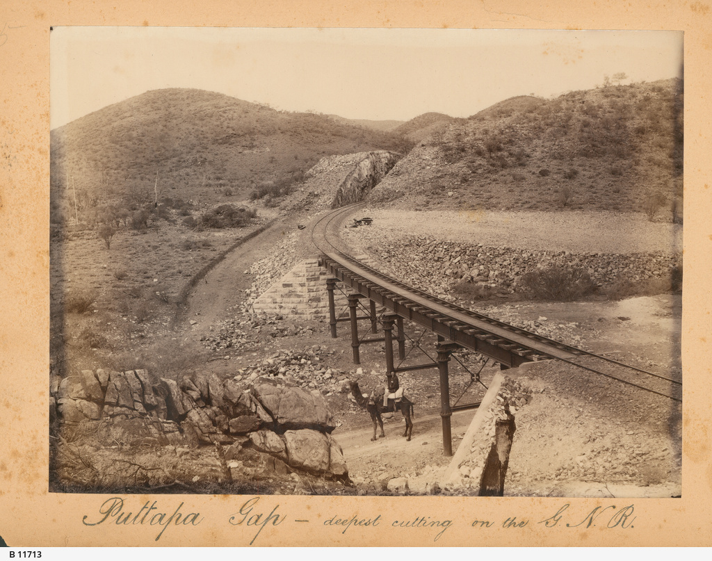
In 1882 Sweet travelled on, and photographed along, the Great Northern Line from Port Augusta to Farina
-
SA colonial photography: a note
In my search for information on expedition photography in South Australia I recently came across a book on colonial photography in Australia entitled Shifting Focus: Colonial Australian Photography 1850-1920
