Tag: South Australia
-
Sturt + the inland sea
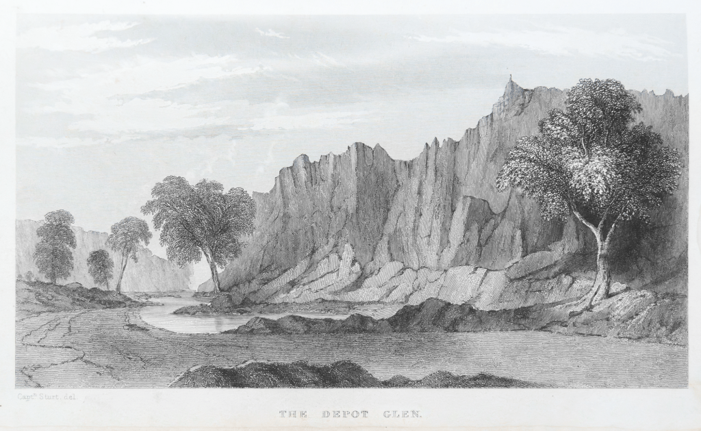
In 1844 Charles Sturt spent a couple of years looking for the inland sea. In 1827, a former East India Company officer Thomas J. Maslen, published this map of the inland sea in his book The Friend of Australia, which provided instructions for surveying and exploring the island-continent’s interior. It was a popular colonial belief that…
-
Iron Knob + history

When I made a quick visit to the Eyre Peninsula in late 2023 with Maleko, our standard poodle, we camped overnight at Iron Knob in South Australia’s Middleback Range. I wanted to spend some time walking around this old mining town to see what was left. I had briefly visited it in passing through the…
-
to Bunyip Chasm

It was a slow drive in the Subaru Outback from the Nudlamutana Hut where we staying to Bunyip Chasm via the Mt McTaggart track, then on part of the Wortupa Loop Track in the Illinawortina Pound. We carefully drove to Grindell’s Hut and then onto Loch Ness Well campground. It took us around 3.5 hours.…
-
Mt Warren Hastings

The first day we decided to do the Oppaminda-Nudlamutana trail as it started near the Nudlamutana Hut where we were staying for the week. We decided to walk this trail to Mt Warren Hastings where we would have our lunch, and then return to the hut. We chose to do a linear walk along a…
-
Blinman
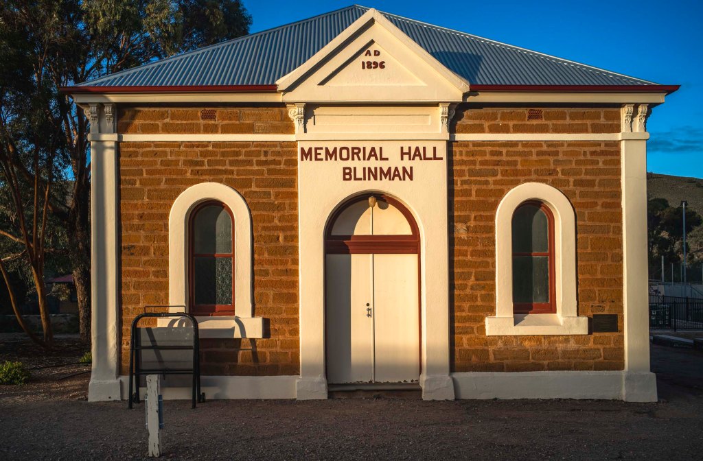
We returned to walking in the northern Flinders Ranges in the winter of 2022. This time we would be on our own both in terms of accommodation at Nudlamutana Hut and walking the various trails in the Vulkathunha-Gammon Ranges National Park and the Arkaroola Wilderness Sanctuary. We stayed overnight in a motel style accommodation behind…
-
Italowie Gap
n the late morning Suzanne and I drove from Balcanoona to Italowie Gap on the Copley Road. We had morning coffee in the Italowie camp ground, drove a kilometre or so into the Gap, and then walked around the bed of the Italowie Creek.
-
Balcanoona

The drive on the Outback Highway from Hawker to the National Park Head Quarters at Balcanonna in the Vulkathunha-Gammon Ranges went north to Parachilna and Copley, and then north east via Nepabunna and Italowie Gorge. The highway to Copley followed the old Central Australia Railway, which closed in 1980 when the standard gauge Tarcoola–Alice Springs Railway…
-
leaving Lake Frome

The morning (1/6/21) of our short walk away from Lake Frome to our pick up point for the return to Blinman was heavily overcast. We could see rain in the northern Flinders Ranges. Lake Frome at the south eastern end of the Lake Eyre Basin to be an intersection point between the winter rains from…
-
Lake Frome: long history and deep time
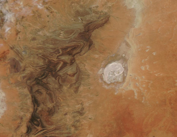
I never made it to Lake Frome proper as we camped on a sand dune on the edge of Chambers Creek floodplain near the western shoreline of this ephemeral lake or salt pan. This stretches over a depression approximately 30 miles wide and 60 miles long It is the most southerly playa in an arc…
-
to Lake Frome
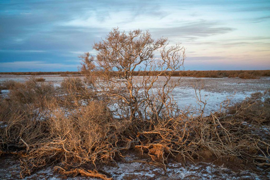
Finally, the day (31st May) that we would reach at Lake Frome dawned. The early morning light was stunning, whilst the colours of the plants on the 2 tree plain were overwhelming.
